Discover the future of mining technology at Con-Mine 2026 Jakarta, taking place from May 20-22, 2026, at JIExpo Kemayoran.
Join 15,000 professionals and 150 exhibitors from 12 countries to explore cutting-edge industry innovations. Partner with PT Exact Global Teknologi to transform your mining operations through advanced slope monitoring sensors, subsurface mapping systems, and digital infrastructure modernization for optimal safety and efficiency.
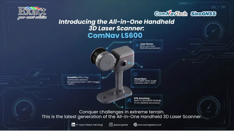
Managing material inventory effectively requires high data accuracy and operational efficiency. Transitioning from slow, conventional contact methods, our latest stockpile mapping service utilizes the integrated GNSS SLAM IMU technology of the SinoGNSS LS600 handheld scanner. Weighing only 1.9 kg with an IP54 industrial rating, this rugged device captures up to 640,000 points per second and utilizes dual 48-Megapixel cameras to generate realistic, colored 3D point clouds. Our successful case study at the PT. SBI warehouse proved its real-world capability, where a 198.14-meter long stockpile was comprehensively scanned in a mere 7 minutes and seamlessly processed into industry-standard CAD/GIS formats using ScanMaster and RealEditor software.
For a detailed technical breakdown and guidelines, you can review the official SLAM LS600 or contact our engineering team directly.
As global traffic loads intensify, maintaining Toll Road Minimum Service Standards (SPM) requires a transition from subjective manual inspections to high-precision digital intelligence. Traditional methods are often slow, dangerous, and lack the depth perception needed to accurately assess structural hazards.
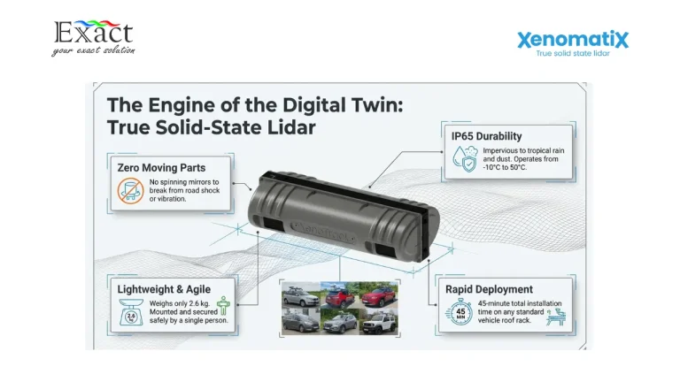
The XenoTrack true solid-state LiDAR system provides a revolutionary approach to expressway inspection. By capturing millimeter-accurate geospatial data at speeds up to 120 km/h, operators can build a comprehensive Digital Twin of the road surface without disrupting traffic flow. Leveraging Edge AI for automated crack detection and georeferencing for seamless GIS/PMS integration, this technology ensures objective contractor accountability and optimizes maintenance budgets. Early intervention, guided by the Pavement Condition Index (PCI), can save up to six dollars in rehabilitation costs for every dollar spent on preservation.
Partner with PT. Exact Global Teknologi, the official distributor for Xenomatix in Indonesia, to protect your infrastructure and achieve absolute mathematical compliance today.
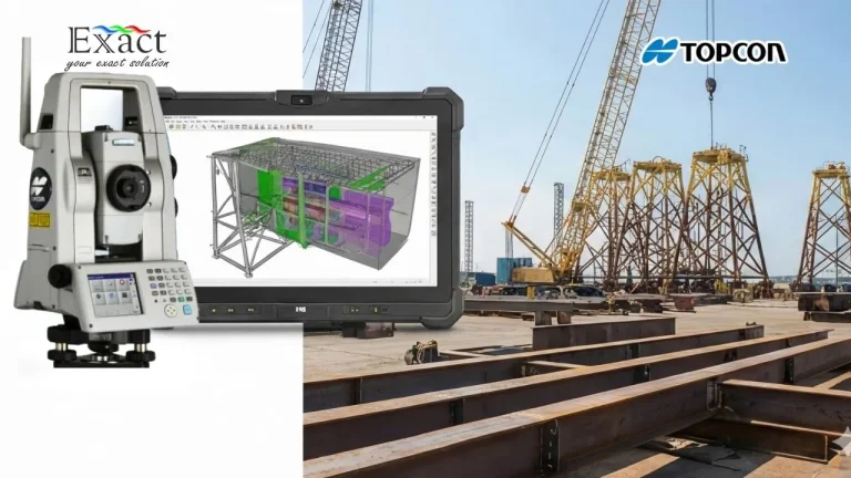
In the heavy infrastructure and offshore sectors, a tiny 4mm measurement error can quickly turn into billions of Rupiah in lost profit due to expensive on-site rework. This executive guide explains how implementing a strict Dimensional Control Survey using the Topcon MS AXII 0.5" robotic total station replaces guesswork with sub-millimeter facts, guaranteeing a First-Time Fit and securing your project's ROI.
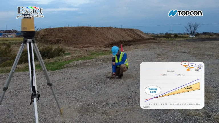
Transform your construction layout workflow with the Topcon LN-160. This robotic layout navigator turns complex surveying into a simple, one-person job. By eliminating the need for a second operator and speeding up stakeout times, project managers can significantly cut labor costs and achieve a full Return on Investment (ROI) in as little as 5 months.
Kami akan membahas Geospasial secara mendalam, konsep dasar, dan aplikasinya. Untuk kebutuhan sewa dan beli alat geofisika, hubungi Exactglobal sekarang.
Dalam era digital dan pembangunan infrastruktur yang pesat, perangkat untuk pengukuran dan pemetaan menjadi komponen vital bagi kesuksesan berbagai proyek. Kami memahami bahwa investasi dalam peralatan berkualitas tinggi berdampak langsung pada efisiensi, akurasi, dan produktivitas tim profesional. Sebagai PT. DINAR ENERGI UTAMA, kami telah menjadi penyedia terpercaya di Jakarta dengan pengalaman luas melayani perusahaan konstruksi, […]