Contact Us Contact us

Berita Geofisika dan Geospasial

Precision Deep Groundwater Mapping in Drought Conditions Without ‘Dry Hole’ Risks

Berita Geofisika dan Geospasial

Precision Deep Groundwater Mapping in Drought Conditions Without ‘Dry Hole’ Risks

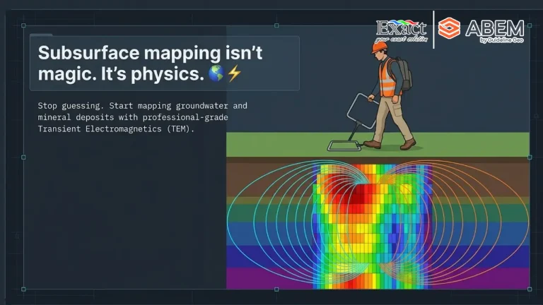
The most accurate solution for deep groundwater exploration during extreme droughts (El Niño) to avoid the risk of dry holes is implementing the "Scout and Detail" workflow. Parched surface soil creates high contact resistance, which causes conventional surveys to fail because electrodes cannot efficiently inject current into the hard ground. To ensure precise drilling site validation, this two-step geophysical survey begins with a rapid scouting phase using the ABEM GroundTEM i-Series, a Transient Electromagnetics (TEM) instrument that scans deep aquifer layers across wide areas without needing to plant metal stakes into the earth. Following this, the detailing phase utilizes the ABEM Terrameter LS 2 directly over the identified anomaly to map 2D/3D geological boundaries, measure aquifer thickness, and clearly differentiate fresh water from impermeable clay beds or saline layers.

Did You Know? An Underground Utility Line is Struck Every Few Minutes Worldwide

Berita Geofisika dan Geospasial

Did You Know? An Underground Utility Line is Struck Every Few Minutes Worldwide

Every year, millions of dollars in damages and project delays occur due to undetected underground utilities, as traditional locators often miss non-conductive assets. To solve this critical challenge, Guideline Geo has launched the MALÅ Easy Locator (EL) Lite—an intelligent, cost-effective Ground Penetrating Radar (GPR) system purpose-built for rapid subsurface utility detection. Ready to work straight out of the box with pre-configured settings and real-time MALÅ AI assistance, it empowers operators to instantly identify and mark buried utilities on-site without complex survey setups or post-processing delays.

How Much Could Your Building Really Lose Without an Earthquake Monitoring System?

Berita Geofisika dan Geospasial

How Much Could Your Building Really Lose Without an Earthquake Monitoring System?

ROBO®QUAKE transforms earthquake risk management from defensive shutdowns into rapid, data-backed operational continuity. During a magnitude 6.5 earthquake, physical structural damage accounts for less than 30% of the total financial impact, while the remaining 70% vanishes through prolonged operational downtime. While traditional manual inspections take 14 to 30 days and cost high-rise owners up to $50,000 (around Rp750 million) per day in lost revenue, automated Structural Health Monitoring (SHM) verifies building safety in just 2 to 5 minutes

Discover “Plug-and-Walk”: Cut Survey Time by Up to 10× Without Complex Setup

Berita Geofisika dan Geospasial

Discover “Plug-and-Walk”: Cut Survey Time by Up to 10× Without Complex Setup

Transform your mineral exploration with the ABEM GroundTEM Trek, distributed by PT. Exact Global Teknologi. This cable-free "Walking TEM" dual-backpack system eliminates heavy line-cutting and slashes setup times from hours to under 10 minutes—delivering real-time subsurface data down to 100 meters. 100% Cable-Free & IP67 Rainproof: Ergonomic 15 kg Tx / 10 kg Rx backpacks built for extreme jungle terrain. Real-Time Inversion: Live pseudo-2D color sections displayed instantly on Android screens. Rapid RKAB Compliance: Map long profile kilometers in days to accelerate MinerbaOne approvals.

Hardware unit Mageba ROBO QUAKE dan sensor getaran gempa FBA dengan latar belakang lanskap perkotaan.

Berita Geofisika dan Geospasial

ROBO®QUAKE: Advanced Earthquake Monitoring Tool for Building Safety Compliance

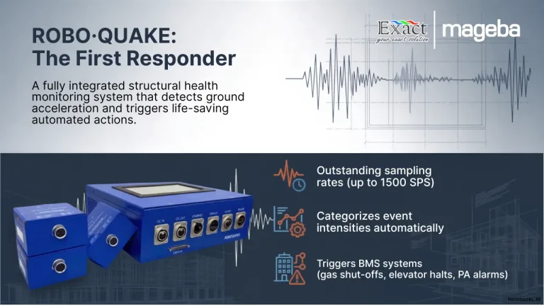
Operating in active seismic regions requires property managers to prioritize structural safety beyond standard regulations . When an earthquake strikes, ROBO®QUAKE serves as an advanced, IoT-compatible Structural Health Monitoring System (SHMS) that delivers immediate, data-driven answers . Unlike regional seismographs, this system utilizes high-precision Force Balance Accelerometers (FBAs) to continuously track your building’s specific structural integrity , , . During a seismic event, the system’s edge computing automatically triggers critical building protection equipment , . Without waiting for human intervention, it safely stops elevators, shuts off main gas and water valves to prevent secondary disasters, and activates evacuation alarms , . Immediately after the shaking stops, ROBO®QUAKE generates comprehensive condition assessment reports within minutes , . Through its secure Digital Twin platform, owners gain real-time visibility into their portfolio's health , . Even during internet outages, on-site teams can view and print physical assessment reports directly from the main unit, ensuring rapid and safe re-occupation decisions.

ROBO®QUAKE Earthquake Monitoring Tool for Buildings

Berita Geofisika dan Geospasial

ROBO®QUAKE Earthquake Monitoring Tool for Buildings

Living in Indonesia's active seismic regions requires proactive infrastructure protection. **ROBO®QUAKE** is an advanced, IoT-compatible Structural Health Monitoring System (SHMS) designed to protect buildings and their occupants during earthquakes. Equipped with high-precision industrial accelerographs, it continuously tracks the vibration status of critical structural components in real time. When dangerous ground acceleration occurs, ROBO®QUAKE instantly triggers automated life-saving actions. It sounds immediate evacuation alarms, sends instant SMS and email notifications, and automatically activates building protection equipment—such as shutting off main gas lines and parking elevators safely. For rapid post-event assessments, the system securely connects to the ROBO®ONE cloud platform for remote engineering analysis. If power or networks fail, it provides redundant on-site data retrieval via an LCD screen and a built-in thermal printer. Supported locally by PT. Exact Global Teknologi, this modular system is the definitive solution for seismic building protection.

Operator sedang mengoperasikan alat Topcon ESN-100 dengan latar belakang struktur jembatan layang beton.

Berita Geofisika dan Geospasial

Comprehensive Guide to 3D Laser Scanner Tools: How It Works, Functions, and Latest Trends

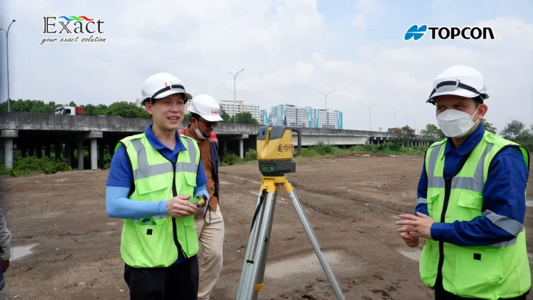
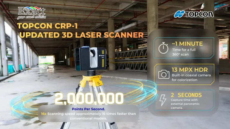
This guide explores how the modern 3D laser scanner tool replaces manual surveying by capturing physical environments into high-density point clouds. It highlights the automated Topcon ESN-100, featuring a "Just Place It!" philosophy with built-in $\pm3^{\circ}$ automatic self-leveling and 100-meter target detection to completely eliminate operator error. Delivering millimeter precision, this terrestrial laser scanner (TLS) seamlessly integrates into BIM workflows, allowing direct data export for automated clash detection and transparent earthwork volume calculations. Backed by empirical evidence from the NPEA project (May 2026), the text demonstrates how 3.6 GB+ of massive spatial data was effortlessly processed on a standard office laptop using MAGNET Collage Office software while maintaining a sub-5mm registration accuracy. Presented by PT. Exact Global Teknologi, this condensed guide serves as an essential technical resource for maximizing efficiency in large-scale infrastructure projects.

Foto alat 3D laser scanner Topcon CR-P1 untuk pemindaian presisi tinggi pada proyek konstruksi

Berita Geofisika dan Geospasial

3D Laser Scanners for BIM: A Complete Guide and Implementation

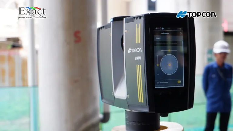
Discover how to maximize project efficiency and data certainty with the Topcon CR-P1, a premier 3D laser scanner tool for BIM. This comprehensive article explores 5 main applications across strategic projects: executing precise Scan to BIM workflows for complex buildings , creating factory Digital Twins with zero operational downtime , and accelerating earthworks tracking through real time cut and fill heat maps. It details how the dual axis compensator optimizes floor flatness and paving checks , while the Resection method secures high accuracy data in hazardous environments from a safe distance. Beyond hardware, we break down the integrated digital workflow of the Topcon Ecosystem , including Collage Site for on site registration , EdgeWise and Verity for smart extraction , and Topcon Enterprise for rapid field to office cloud exchange. Backed by professional training from PT Exact Global Teknologi , this system delivers absolute accuracy and measurable ROI. Read our full guide to upgrade your surveying standards.

MS-SAR5000

Berita Geofisika dan Geospasial

Complete Specifications of the ComNav MS-SAR5000 and Its Competitive Advantages vs. Conventional Radars

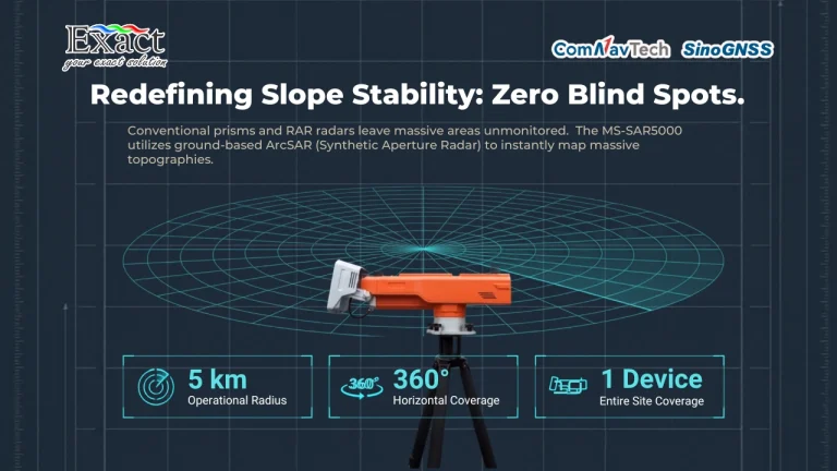
The ComNav MS-SAR5000 is a professional-grade, non-contact slope stability monitoring radar precisely designed to perform real-time ground surface displacement measurements for open-pit mines and areas prone to geological disasters. Moving beyond the limitations of conventional contact tools and older Real Aperture Radar (RAR) technology, the MS-SAR5000 utilizes ground-based Synthetic Aperture Radar (ArcSAR) and Differential Interferometry (D-InSAR) to provide a full 360-degree horizontal coverage up to a 5-kilometer radius, eliminating dangerous blind spots.