Contact Us Contact us

alat geofisika

Did You Know? An Underground Utility Line is Struck Every Few Minutes Worldwide

Berita Geofisika dan Geospasial

Did You Know? An Underground Utility Line is Struck Every Few Minutes Worldwide

Every year, millions of dollars in damages and project delays occur due to undetected underground utilities, as traditional locators often miss non-conductive assets. To solve this critical challenge, Guideline Geo has launched the MALÅ Easy Locator (EL) Lite—an intelligent, cost-effective Ground Penetrating Radar (GPR) system purpose-built for rapid subsurface utility detection. Ready to work straight out of the box with pre-configured settings and real-time MALÅ AI assistance, it empowers operators to instantly identify and mark buried utilities on-site without complex survey setups or post-processing delays.

Hardware unit Mageba ROBO QUAKE dan sensor getaran gempa FBA dengan latar belakang lanskap perkotaan.

Berita Geofisika dan Geospasial

ROBO®QUAKE: Advanced Earthquake Monitoring Tool for Building Safety Compliance

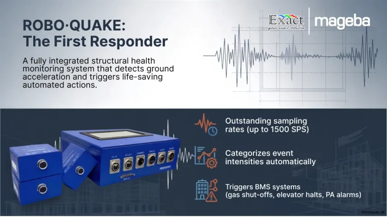
Operating in active seismic regions requires property managers to prioritize structural safety beyond standard regulations . When an earthquake strikes, ROBO®QUAKE serves as an advanced, IoT-compatible Structural Health Monitoring System (SHMS) that delivers immediate, data-driven answers . Unlike regional seismographs, this system utilizes high-precision Force Balance Accelerometers (FBAs) to continuously track your building’s specific structural integrity , , . During a seismic event, the system’s edge computing automatically triggers critical building protection equipment , . Without waiting for human intervention, it safely stops elevators, shuts off main gas and water valves to prevent secondary disasters, and activates evacuation alarms , . Immediately after the shaking stops, ROBO®QUAKE generates comprehensive condition assessment reports within minutes , . Through its secure Digital Twin platform, owners gain real-time visibility into their portfolio's health , . Even during internet outages, on-site teams can view and print physical assessment reports directly from the main unit, ensuring rapid and safe re-occupation decisions.

ROBO®QUAKE Earthquake Monitoring Tool for Buildings

Berita Geofisika dan Geospasial

ROBO®QUAKE Earthquake Monitoring Tool for Buildings

Living in Indonesia's active seismic regions requires proactive infrastructure protection. **ROBO®QUAKE** is an advanced, IoT-compatible Structural Health Monitoring System (SHMS) designed to protect buildings and their occupants during earthquakes. Equipped with high-precision industrial accelerographs, it continuously tracks the vibration status of critical structural components in real time. When dangerous ground acceleration occurs, ROBO®QUAKE instantly triggers automated life-saving actions. It sounds immediate evacuation alarms, sends instant SMS and email notifications, and automatically activates building protection equipment—such as shutting off main gas lines and parking elevators safely. For rapid post-event assessments, the system securely connects to the ROBO®ONE cloud platform for remote engineering analysis. If power or networks fail, it provides redundant on-site data retrieval via an LCD screen and a built-in thermal printer. Supported locally by PT. Exact Global Teknologi, this modular system is the definitive solution for seismic building protection.

Akuisisi GPR MALA ProEx RTA

Berita Geofisika dan Geospasial

The Ultimate Guide to Ground Penetrating Radar Frequency: Why the Flexible 30MHz Antenna is the Best Solution for Deep Penetration in Extreme Terrains

The MALÅ Rough Terrain Antenna (RTA) 30MHz is a specialized Ground Penetrating Radar (GPR) solution engineered for deep subsurface investigations in challenging environments like thick forests and rocky mountains. Featuring a unique "snake-like" flexible design, this unshielded antenna can be maneuvered easily through dense vegetation and uneven terrain without the need for time-consuming land clearing. Its low-frequency 30MHz signal offers maximum depth penetration, making it highly effective for depth-to-bedrock mapping, glaciology, and deep groundwater resource identification. When integrated with the MALÅ ProEx Control Unit, the system supports multi-channel data collection, allowing users to reduce project timelines and manpower requirements by up to two-thirds compared to traditional antennas.

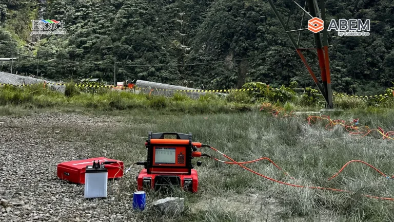
ABEM Terrameter LS 2 in the field

Berita Geofisika dan Geospasial

Tips for Choosing a Professional Geoelectrical Service: Why ABEM Terrameter LS 2 is the No. 1 Choice in Indonesia

Selecting a professional geoelectrical service is critical for the success of major projects, requiring uncompromised data accuracy and high-resolution results for tasks such as groundwater prospecting and mineral exploration. This guide highlights the ABEM Terrameter LS 2 as the premier choice in Indonesia, featuring isolated measurement channels with dedicated 24-bit digitizers to prevent signal interference. Key advantages include revolutionary 100% Duty Cycle IP for faster, high-quality data collection and a rugged IP66-rated aluminum casing built to withstand harsh tropical environments. Additionally, its smart technology enables remote monitoring via VNC and instant troubleshooting over a VPN, significantly minimizing project downtime. Backed by PT. Exact Global Teknologi, the official distributor in Indonesia, the system ensures versatile applications across various sectors and exceptional after-sales support.

ABEM GroundTEM i-Series

Berita Geofisika dan Geospasial

Official Distributor of ABEM GroundTEM i-Series Indonesia: Fastest Groundwater & Mineral Survey Tool — Finishes 5 Points/Day!

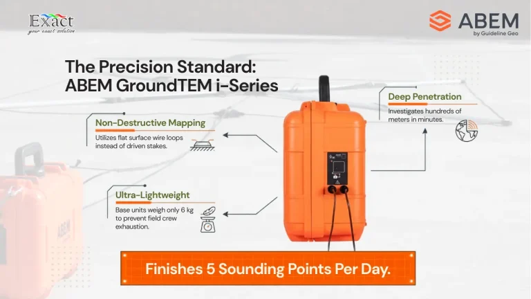
Official Distributor of ABEM GroundTEM i-Series Indonesia: Fastest Groundwater & Mineral Survey Tool As we prepare for Mineral Deposit Exploration 2026, field efficiency and data precision have become the top priorities for geophysicists across the archipelago. The ABEM GroundTEM i-Series stands out as Indonesia’s fastest survey tool, enabling field teams to complete up to five sounding points per day by eliminating the need for invasive electrodes and heavy cabling. By utilizing the Transient Electromagnetic (TEM) method, this system captures high-resolution subsurface data through magnetic induction, reaching depths of hundreds of meters in just minutes. Featuring advanced dual-moment technology, the i-Series provides simultaneous precision for both shallow and deep geological structures.Designed for the rugged Indonesian terrain with an IP65 rating and wireless Android app control, it offers a "Real-time inversion" feature for immediate on-site decision-making. Partner with PT. Exact Global Teknologi, the official distributor, to revolutionize your exploration workflows with the most portable and powerful TEM solution on the market.

Gambar Beli Alat Geofisika

Beli Alat Geofisika

Beli Alat Geofisika untuk Eksplorasi Tambang: Pilihan Terbaik dan Estimasi Biaya

Memilih perangkat survei bawah permukaan adalah langkah penting bagi kesuksesan proyek pertambangan. Investasi ini membutuhkan pertimbangan yang matang karena menyangkut akurasi data dan teknologi yang digunakan. Kami hadir untuk memandu Anda melalui proses ini. Panduan komprehensif ini dirancang untuk memberikan informasi terperinci sebelum Anda melakukan pembelian. Eksplorasi modern sangat bergantung pada metode canggih untuk memetakan […]